Wind and Waves and Weather – Baja California Sur
Scroll Down to see Sea Surface Temps, Satellite Imagery, Wind Speeds, Pressure Gradients, Moon Phases, and more!
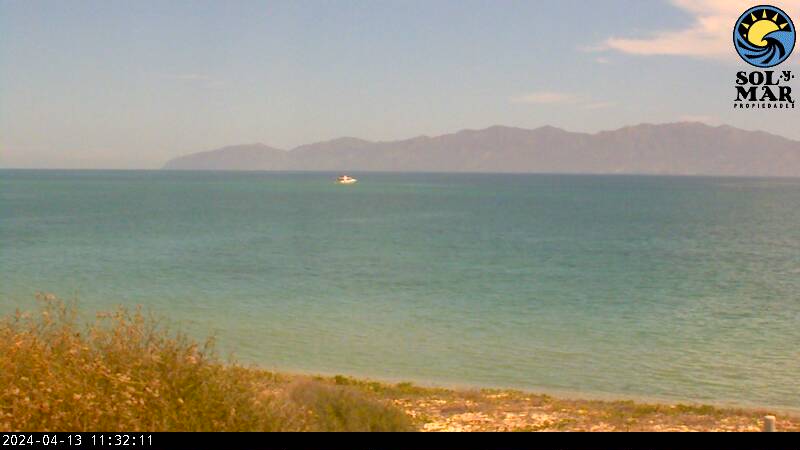
Live from South Beach in La Ventana – This Image Updates Every Few Minutes – Hit Refresh If It Doesn’t Automatically
Scroll Down for Current Wind Report
Infrared Satellite Radar – Baja California Sur
North America -Surface Weather Analysis
High Pressure Near the Top of The Sea of Cortez means WIND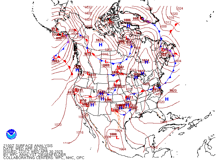
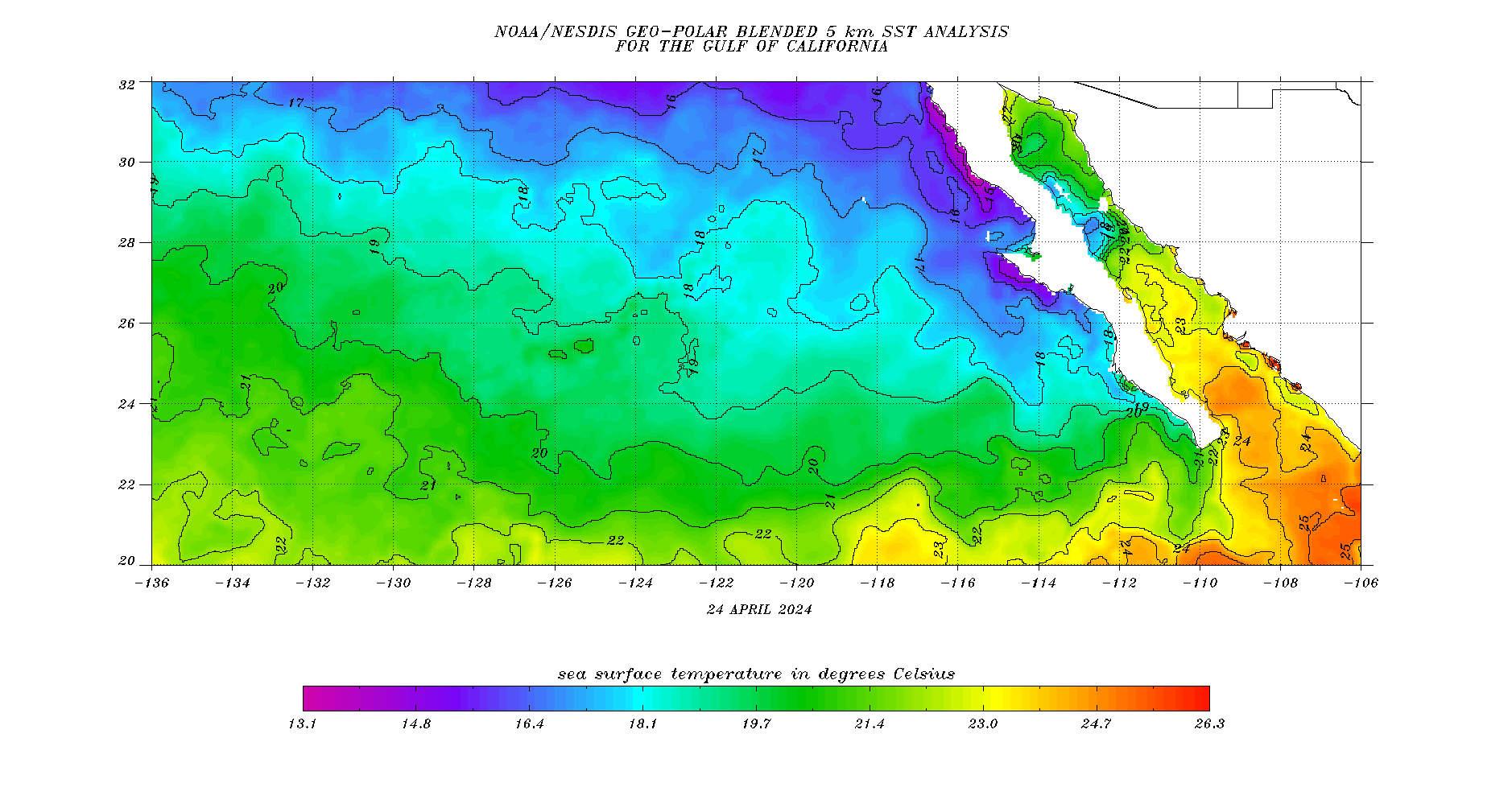
Baja Sea Surface Temperatures in Celsius
Great for Fishing, Scuba, Surfing, Kiteboarding, and other Watersports
Water Temperatures for Cabo San Lucas, La Paz, and all of Baja
![]()
Baja West Coast Forecast Wave Height & Direction
Great for Planning and Predicting Surf Conditions
][(0.0)][(21):(47.5)][(225.5):(252)]&.draw=surface&.vars=longitude|latitude|Thgt&.colorBar=|||||)
Visible Satellite Image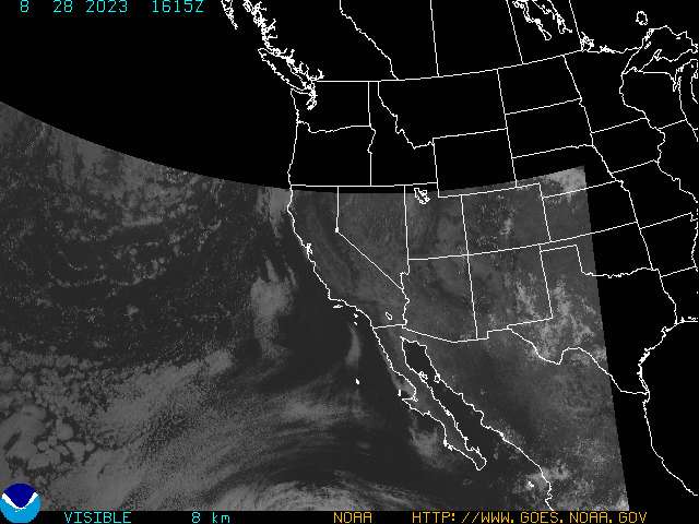
Baja Moon Phase